Why Professional Cycling Makes GPS Tracking Harder
Between 2010 and 2015, we served as Official Technology Partner to Team Sky, the professional cycling team backed by BSkyB. During those five years, the team won multiple Tour de France titles with Bradley Wiggins and Chris Froome. Our Map My Tracks platform provided GPS tracking technology for their training programmes.
Professional cycling exposed technical challenges that don't surface with casual fitness tracking. UCI rules prohibit GPS devices during official races, limiting our technology to training applications. This meant building systems that worked reliably during intensive preparation sessions in remote locations, often lasting six to eight hours with limited access to power.
The technical constraints were straightforward: maintain GPS accuracy across varying speeds and terrain, preserve battery life for extended sessions, function reliably without continuous network connectivity, and provide performance data useful for professional coaching analysis.
These same constraints apply to commercial applications. Field service workers need all-day tracking without constant charging. Logistics platforms require accurate positioning at motorway speeds. Construction site apps must function in areas with poor network coverage. The technical principles don't change.
Battery Life Versus GPS Sampling Frequency
GPS receivers drain batteries quickly. The sampling frequency determines how often the device queries satellite positioning. Higher frequency means better route accuracy but faster battery depletion.
Most developers default to fixed sampling rates: every five seconds, every ten seconds, every thirty seconds. This simplifies implementation but ignores the relationship between movement speed and required accuracy.
A cyclist climbing a mountain at 12 km/h doesn't need the same positioning frequency as the same cyclist descending at 65 km/h. Walking speed allows longer intervals between GPS pings. High-speed movement requires more frequent sampling to capture rapid position changes accurately.
We implemented adaptive sampling that adjusts GPS query frequency based on current velocity. Lower speeds use longer intervals between position checks, conserving battery. Higher speeds increase sampling frequency to maintain route accuracy through rapid movement.
This approach extends battery life during portions of activity where high-frequency sampling provides minimal accuracy benefit. The same cyclist doing a six-hour training session experiences significantly better battery performance without sacrificing route quality during technically demanding descents.
The principle applies broadly. Delivery drivers spend time stationary during drop-offs and moving at speed between locations. Field service engineers walk through sites slowly and drive between jobs quickly. Adaptive sampling optimises battery consumption based on actual movement patterns rather than fixed assumptions.
GPS Accuracy at Different Speeds
Consumer GPS chips are optimised for predictable movement patterns. Pedestrians walking at 5 km/h. Cars travelling at 110 km/h on motorways. The positioning algorithms assume relatively steady velocity with gradual direction changes.
Professional cyclists violate these assumptions. Alpine descents involve rapid acceleration from 15 km/h through tight corners to 70 km/h on straight sections, then hard braking for the next bend. This happens repeatedly across 30-minute descents.
Standard GPS algorithms interpret sudden velocity changes as positioning errors. The logic assumes movement shouldn't accelerate that quickly, so it applies smoothing that corrupts the actual route. What appears as erratic speed data is often genuine movement that falls outside expected parameters.
We addressed this through validation logic that checks acceleration against terrain characteristics. A rider can legitimately accelerate from 20 km/h to 65 km/h on a steep descent. That's physically possible on a bicycle. Sudden lateral movement of 200 metres in two seconds isn't.
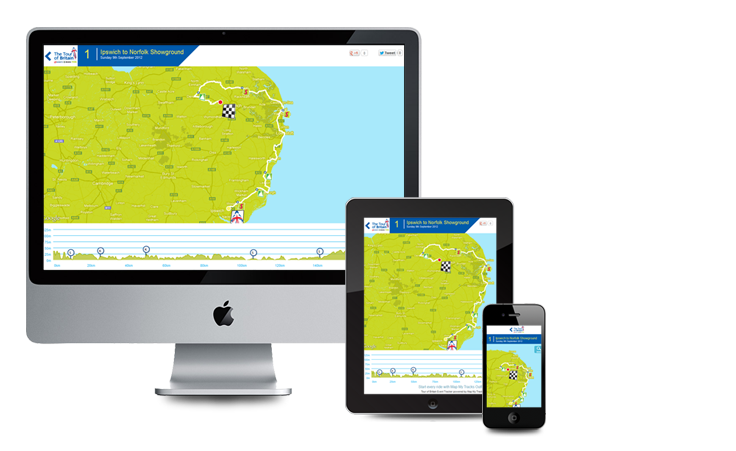
This became critical for Tour of Britain in 2012, where we provided official live tracking using GPS devices in race vehicles following the peloton. Vehicles needed accurate positioning during technical descents at speeds matching the riders. Standard GPS smoothing would have degraded the broadcast-quality tracking data.
The same challenge affects logistics applications. Delivery vans accelerate rapidly from stops to 50 mph within seconds. Without velocity-aware validation, GPS systems misinterpret this legitimate movement as positioning noise and apply corrections that reduce accuracy.
Offline-First Architecture for Unreliable Connectivity
Professional cyclists train in locations chosen for difficulty, not mobile coverage. Mountain passes, remote climbs, and rural training routes often feature intermittent or absent mobile signal.
Standard GPS applications handle connectivity loss poorly. They either stop recording when network disappears or create gaps in activity data. Neither approach works when complete training sessions are required for performance analysis.
We built offline-first architecture where GPS recording continues regardless of network state. The application buffers positioning data locally in the device's database. When mobile connectivity returns, accumulated data transmits automatically without requiring user intervention.
The implementation requires careful handling of background processes. Active GPS recording takes priority over background data transmission. Upload tasks throttle themselves during active sessions to avoid competing for processor resources. Data transmission occurs in managed batches rather than attempting to upload hours of buffered data simultaneously.
We also implemented compression that significantly reduces GPS payload size. Binary encoding of coordinate pairs uses substantially less bandwidth than text-based formats. When multiplied across thousands of position points per session, this compression meaningfully reduces both transmission time and mobile data consumption.
This same offline-first pattern now underpins field service applications. Construction sites, utilities infrastructure in remote locations, and rural delivery routes all feature unreliable connectivity. The architectural approach remains identical: record locally, sync intelligently, preserve all data.
Handling GPS Signal Degradation
GPS positioning requires clear line-of-sight to satellite constellations. Mountain valleys, tree cover, and urban environments all degrade satellite visibility. Rather than failing completely, signal often degrades intermittently.
Standard GPS implementations handle partial signal loss by marking questionable data points for smoothing. The algorithm interpolates between last-known and next-known positions. For walking or driving on roads, this produces acceptable results.
For cycling through varied terrain, interpolation creates inaccurate routes. The system draws straight lines between positions where signal was reliable, missing the actual path travelled during degraded reception.
We implemented predictive positioning during signal degradation. The system tracks velocity and bearing during good satellite lock. When signal weakens, position is estimated based on last-known movement vector. These estimates are retrospectively corrected when satellite lock improves, comparing predicted against actual GPS coordinates.
The mathematics are straightforward. Distance equals velocity multiplied by time. Track movement at 32 km/h on a specific bearing. Lose reliable satellite lock for eight seconds. Estimate position along that bearing. Regain satellite positioning. Compare estimated against actual position and apply corrections to buffered data points.
This approach maintains continuous route tracking through terrain where satellite visibility fluctuates. The Tour of Britain web platform used the same logic for race vehicle tracking, ensuring reliable positioning data throughout eight stages across varied British countryside with inconsistent satellite reception.
Commercial outdoor tracking in any varied terrain benefits from predictive positioning during signal degradation. The implementation cost is modest compared to the reliability improvement.
What a Million Users Taught Us
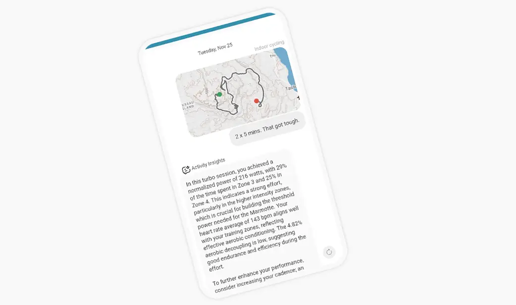
Map My Tracks, our GPS fitness tracking platform, now processes GPS tracks from over a million users globally. The platform handles everything from casual dog walking to ultra-distance running, from weekend cycling to professional training sessions.
This scale reveals patterns invisible at smaller volumes. We've processed millions of GPS tracks across every terrain type, weather condition, device model, and network environment. This dataset provides insights about GPS behaviour that single-project experience cannot match.
Battery drain varies significantly across device models. An iPhone 12 handles continuous GPS recording differently than a Samsung Galaxy S21, which differs from a Google Pixel 6. Adaptive battery management must account for hardware-specific characteristics, not assume uniform behaviour.
Network handoff patterns differ by carrier and geography. GPS applications that work reliably on one mobile network may experience synchronisation problems on another. Offline-first architecture matters more in some regions than others based on infrastructure coverage.
User behaviour is less predictable than professional training patterns. Recreational athletes pause activities mid-session, forget to stop recording, or use GPS tracking in ways we never anticipated. Building robust systems requires handling edge cases that professional use never encounters.
The technology we developed for Team Sky needed to work reliably for Tour de France champions during intensive training. That same technology now handles unpredictable recreational use at global scale. The principles remain constant: preserve battery life, maintain accuracy across variable conditions, function without continuous connectivity, and process positioning data reliably.
Applying Professional Sport Lessons Commercially
The GPS tracking we engineered for professional cycling translates directly to commercial sports applications where positioning accuracy and reliability matter.
Field service tracking requires similar capabilities. Workers need all-day battery life without constant charging. Remote locations demand offline-first architecture. Variable movement speeds benefit from adaptive sampling. The technical requirements mirror professional training applications.
Logistics platforms face identical challenges. Delivery vehicles operate at variable speeds across diverse terrain. Network coverage varies significantly across routes. Battery life matters for driver devices used throughout shifts. Speed-aware GPS validation improves positioning accuracy.
Live event tracking, whether sporting competitions or public gatherings, requires scalable infrastructure that handles significant traffic spikes whilst maintaining reliability. The patterns we established with Tour of Britain - vehicle-based tracking, real-time data streaming, broadcast-quality positioning - apply to any time-critical public event coverage.
Construction site management benefits from the same offline-first architecture we built for remote training locations. Sites often have poor network connectivity. Workers need reliable tracking that captures data regardless of mobile coverage, syncing when signal becomes available.
What Professional Sport Proves
Professional sports partnerships validate technical capabilities under demanding conditions. Building systems for Tour de France champions tests reliability standards that casual development never encounters.
The technology we delivered for Team Sky needed to function during preparation for the world's most demanding cycling races. Coaches required dependable performance data. Riders needed tracking that worked reliably across varied training environments. Battery life had to support extended sessions without compromise.
This proving ground informed everything we've built since. When we develop GPS tracking for commercial applications, the underlying architecture has been tested at professional sport's highest level. The constraints change - different battery requirements, varied use patterns, distinct accuracy needs - but the foundational principles remain.
Map My Tracks demonstrates this at scale. Over a million users rely on tracking technology proven with professional cyclists. The platform processes millions of GPS points daily using infrastructure designed to handle both Tour de France champion training rides and everyday recreational activities simultaneously.
The lessons from professional cycling aren't exotic edge cases. They're fundamental GPS tracking challenges that every outdoor application encounters: battery optimisation, variable-speed accuracy, offline operation, and reliable data processing. Professional sport simply exposes these challenges more acutely than casual use.
Need an app or website?
Get in touch to discuss how we can help create an app of your own or find out how our Fractional Product Team can support your development journey from MVP through to scale.